Geospatial variation in development: Some insights from satellite images
Abstract
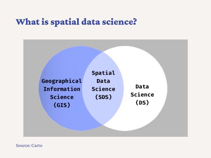
This presentation provides an introduction to the analysis of geospatial development. Specifically, it covers the following three topics: (1) What is geospatial development? How does it complement micro and macro studies? (2) How can we study geospatial development? How important are satellite images in measuring geospatial development? (3) What is spatial data science? In which way is it different from standard data science? The presentation concludes by highlighting some additional learning materials and tutorials.
Date
Aug 19, 2022 2:45 PM
Location
India and Virtual
Carlos Mendez
Associate Professor of Development Economics
My research interests focus on the integration of development economics, spatial data science, and econometrics to better understand and inform the process of sustainable development across regions.